King tides provide peek at rising seas
Published 5:53 am Friday, December 16, 2016
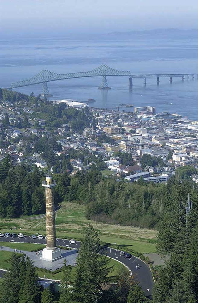
- Rising tidal surges, like the 10-plus-foot king tides that hit the Astoria-Warrenton area Monday through Thursday, can help hydrate restored wetlands like Daggett Point in the foreground, but can put pressure on diked land.
The second of this winter’s three king tide events hit Monday through Thursday, sending tidal surges up to more than 10.5 feet around Warrenton and Astoria.
King tides, also known as perigean spring tides, are the highest-predicted tides of the year. They occur with the orbital alignment of the earth, sun and moon, pushing tides higher than usual and providing a glimpse into a future of rising sea levels.
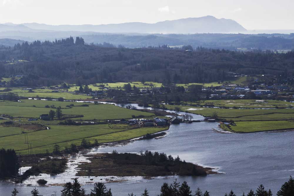
By the time the tide peaked at around 10.5 feet Tuesday, water from Youngs River had risen within inches of the lanes of travel on Oregon Highway 202, one of the most striking local examples of tidal effects on infrastructure.
“The biggest effect is erosion along the shoulder of the road,” said Kevin Werst, a transportation maintenance manager with the state Department of Transportation.
When tides peak in Seaside, the city’s Public Works Director Dale McDowell said, he sends staff to monitor The Cove, a thin strip of rocky beach littered with driftwood and popular with surfers and other beachgoers.
“We basically station a guy down by The Cove, because the waves can throw logs up,” he said, adding the city will sometimes close the entire beach down.
The city also sends staff to watch for debris blockages during high flows under the city’s bridges and for erosion around its sewage plant, located next to the mouth of the Necanicum River. McDowell said the river’s flow comes right up to the edge of the plant, where a couple of years ago the city installed a barricade to protect against erosion.
Werst and other local public works officials said king tides in themselves don’t pose an immediate threat, unless combined with high winds and rain during storms. The effects of this week’s king tides, unaccompanied by foul weather, were benign.
“On the Oregon Coast in the wintertime, we have sea level rise of 18 inches in the winter, because of various reasons,” said Patrick Corcoran, a coastal hazards specialist with Oregon State University’s Extension Service in Astoria. “When you combine that with king tides, that’s when things start flooding.”
In Warrenton, the king tide peaked at more than 10.7 feet in the Skipanon River Tuesday. Collin Stelzig, Warrenton’s city engineer, said the city can experience tides of 11 feet amid storm surges multiple times of year, without issues.
“We’re protected by levees, so we don’t necessarily have an impact from these tides,” he said.
Stelzig said the city has been part of the Federal Emergency Management Agency’s National Flood Insurance Program since 1978 and faced tides as high as nearly 12.6 feet in 1983, but has never had a claim for flooding.
The situation in the Pacific Northwest isn’t as bad as Florida, where one-eighth of the homes could be underwater by 2100 if sea levels rise as predicted, according to real estate company Zillow.
“Our geography is different,” said Meg Reed, a coastal shores specialist with the Oregon Coastal Management Program. “We don’t have a lot of low-lying developed beaches like Florida.”
Sea level rise is mitigated on much of the West Coast by the Juan de Fuca plate sliding under the North American plate, causing a tectonic uplift of between 1.5 and 3 millimeters per year. But at some point, Reed said, sea level rise will likely outpace the tectonic uplift, because of exponentially increasing warming.
According to a 2012 report from the National Research Council, sea levels on the West Coast could rise 3 to 9 inches by 2030, and 7 to 19 inches by 2050, relative to 2000 levels. According to the report, the rate of global sea level rise increased from about 1.7 millimeters per year during the 20th century to 3.1 millimeters per year since 1993.
“We know that we have a very dynamic winter climate, so even a little bit of sea level rise means those storms will get more intense,” Reed said, adding chronic issues like erosion and landslides could worsen.
Add to the list of problems a Cascadia Subduction Zone earthquake, which the state Department of Geology and Mineral Industries estimates could sink the land 3 to 7 feet, immediately reversing hundreds of years of tectonic uplift.
Reed said improving resiliency to tsunamis will also help with issues of rising sea levels and erosion. She previously worked as a coastal fellow with the National Oceanic and Atmospheric Administration for the Coastal Management Program, researching areas of the coast that could benefit from shore armoring. Her successor in the position, Julie Sepanik, is looking at the threats facing coastal and estuarine infrastructure from king tides.
Reed’s department, the local Surfrider Foundation chapter and the Oregon Coastal Shores Conservation Coalition’s CoastWatch group oversee the Oregon King Tides Photo Initiative, a citizen science effort to document the reach of tides over time.
“Because our impacts of sea level rise are not immediate, we have a little more time to rethink how we’re doing development,” she said.
Reed said photos from the project have been used by state transportation officials looking at areas of erosion like Beverly Beach, where U.S. Highway 101 runs close to a quickly eroding beachfront cliff.
The project asks people in coastal and estuarine areas to take pictures of areas facing erosion and flooding, create contrasting shots at king and regular high tides and submit the photos online.
The next king tide event hits Jan. 10 to Jan. 12. Afterward, Reed said, organizers are planning end-of-season parties, including one in Seaside, to review all the photos.
For more information on the program and a schedule of tides, visit www.oregonkingtides.net