Now it’s here, now it’s gone
Published 5:00 pm Monday, March 28, 2011
I sat transfixed as the tsunami tore through fields, collapsed houses and washed over highways with unleashed force and fury that night when all hell broke loose.
It was 11 p.m. and I was just about to head for bed, when, suddenly, there on the wide-screen TV, real-time tragedy was occurring in my own living room.
But, instead of being in Japan, I was in Cannon Beach, wondering how the proposed tsunami evacuation building would withstand such turbulence, whether people would really be able to run to higher ground fast enough, if the bridge over Ecola Creek would stand enough minutes to provide an evacuation route.
Despite all of the preparations we had made, would those plans ensure safety for ourselves, our loved ones, our town?
I suspect no one has that answer right now, but many may be rethinking their assumptions.
For Japan, the 9.0 earthquake about 80 miles offshore, the tsunami, the fires and radiation leaks from the nuclear power plants is a horrendous tragedy. For us here on the Oregon Coast, it is a lesson to be studied.
Only two days before the earthquake, I had written a story about how many people might reach one of several assembly areas designated for Cannon Beach. A computer simulation, presented by Jonathan Karon from Oregon State University, projected the number of people who might run to the proposed City Hall/tsunami evacuation building or up Sunset Hill, over the Ecola Bridge, toward milepost 30 on U.S. Highway 101, up to the Haystack Hill viewpoint or to Haystack Heights, east of the highway.
If the 30-foot tall, reinforced tsunami evacuation building, built on reinforced concrete and steel pilings deep into the ground, existed, Karon estimated that nearly 4,700 people might seek shelter there on a summer day.
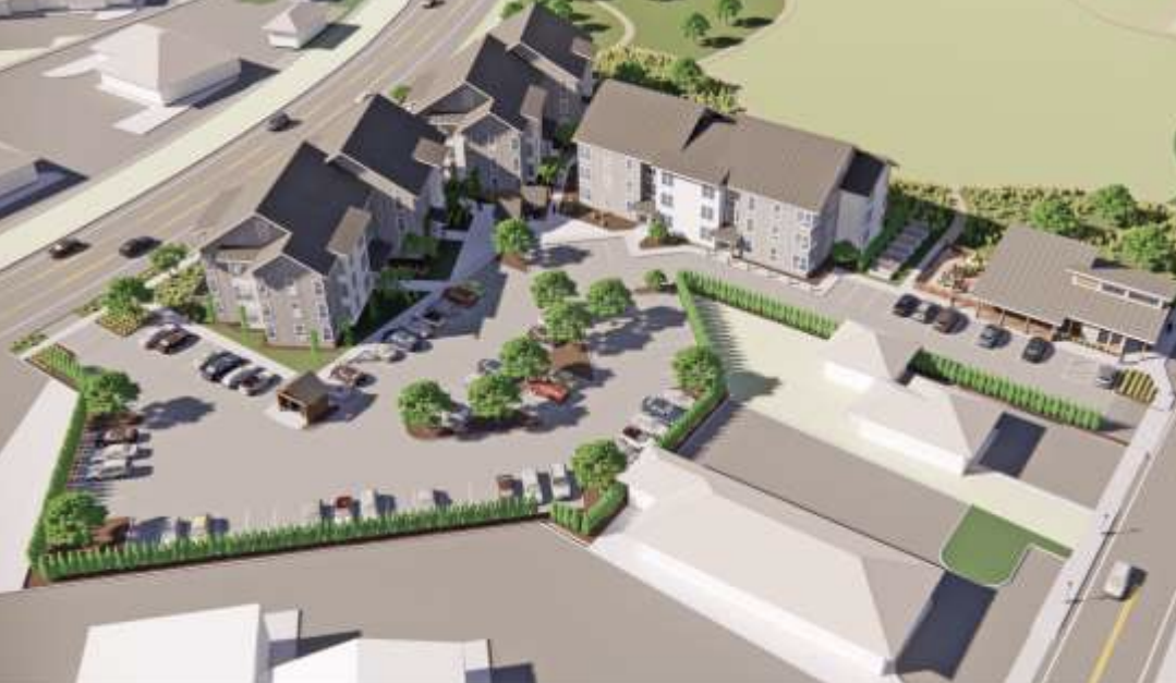
The preliminary sketches for the building show a wide staircase leading to a roof that would hold an estimated 1,000 to 1,500 people.
With that in mind, and knowing that the City Hall was only about three blocks from the beach, I watched the aerial view of the tsunami rushing at houses and concrete structures alike and mowing them down like pins in a bowling alley.
My eyes lingered on the few buildings that did remain. What caused them to keep standing? Would they collapse eventually? Were the people inside still alive?
The comment I heard in a meeting recently kept echoing in my head as I watched the replay of that same wave: The buildings at the beachs edge in Cannon Beach even those that appear to be higher up are built on sand dunes and would fall at the earthquakes first shudder. If that happens, theres no bulwark to withstand a wave the ferocity of what I saw on television that night.
Even our geography, with surrounding hills and areas of high ground may not provide much protection, as a New York Times op-ed piece, published March 19, points out. The writer talks about the rugged Sanriku Coast of northeastern Japan with cliffs, rock pillars and narrow river valleys.
Having experienced past tsunamis, the town of Taro on the Sanriku Coast became a tsunami preparedness town in 2003, according to the Times article. City officials worked with local universities, installed a satellite link to learn of potential tsunamis sooner, educated its citizens and prepared detailed maps showing how high tsunami waves could reach. Evacuation areas were established at lines above the point where the 1896 tsunami hit, 120 feet high in one village. The steep valley walls and deep inlets channeled the tsunamis energy then, creating swells to stunning heights, the article said.
But the evacuation areas were put in the wrong place, and, the waves during the latest tsunami overwhelmed Taro, according to the story. The costs, it said, are still being tallied.
In just a few minutes or less, everything in the path of that wave on my television screen splintered. I watched helplessly as cars stalled on the highway and wondered what the people in those cars were thinking as the wave approached.
It might not seem possible that the wave could approach our highway, but take a close look at the tsunami evacuation map prepared for Cannon Beach by scientists from the state Department of Geology and Mineral Industries. It shows where, according to 300-year-old sand deposits, the tsunami of 1700 landed: one mile east of what is now Highway 101.
A few days after the disaster played out in my living room, the tsunami arrived on my computer, in YouTube videos and photos from CNN.
I relived it again as I watched what, at first, was about an inch of water coming around the corner in the middle of a downtown street become a torrent that spun vehicles in whirlpools and loosened local shops off of their foundations.
The CNN photos captured the destruction close-up, in the eyes of those still left alive. A doctor, his mouth covered with a mask and his forehead resting on his palm, clearly shaken by what he had seen. A young girl sitting on a sidewalk, surrounded by heaps of debris, crying. Photo after photo of destroyed houses, fishing boats, buildings pushed onto broken highways, empty land where towns used to be.
One of the most startling photos for me was of a huge yacht resting atop a scoured concrete building surrounded by the toothpick remains of other destroyed buildings.
It reminded me of the recent public television documentary that talked about catastrophic earthquakes. The program briefly discussed Cannon Beachs plans for the tsunami evacuation building and included an animation showing how the building would be able to withstand a fishing boat hitting the pilings. What would happen to the thousands of people projected to be on the roof of that building if debris washed over them?
While the evacuation conducted the morning after Japans tsunami in Cannon Beach and Seaside went smoothly, from warning hotel visitors and residents, to opening up temporary shelters in each town, emergency crews had several hours to prepare.
But city officials in both towns admit that in the case of the Big One, such a calm outcome wouldnt occur. As Cannon Beach City Manager Rich Mays sat in City Hall at 5 a.m. the day after Japans disaster struck, he worried about what the city would do to shelter the survivors after a nearby tsunami struck.
In Seaside, City Manager Mark Winstanley also worried. People will have to save themselves, he said. We will not be able to save you.
Someone else, who also had seen the videos and read the newspaper stories, wondered whether any pre-tsunami planning would save anyone and offered this suggestion if a tsunami headed our way: Maybe we should just drink the poison and say we had a good life.
The miracle of real-time video definitely made it clear: We can do all the studies we want and have all of our plans in place, but the mind-shuddering reality of what could happen what did happen is that what we know could be upended in an instant. Now how do we prepare for that?
Nancy McCarthy is the South County reporter for The Daily Astorian. She writes a column for the Cannon Beach Citizen.


